13-Mile Course (21k)
Sunday, AUGUST 23, 2026 • 8:00AM START AT Telluride Town Park
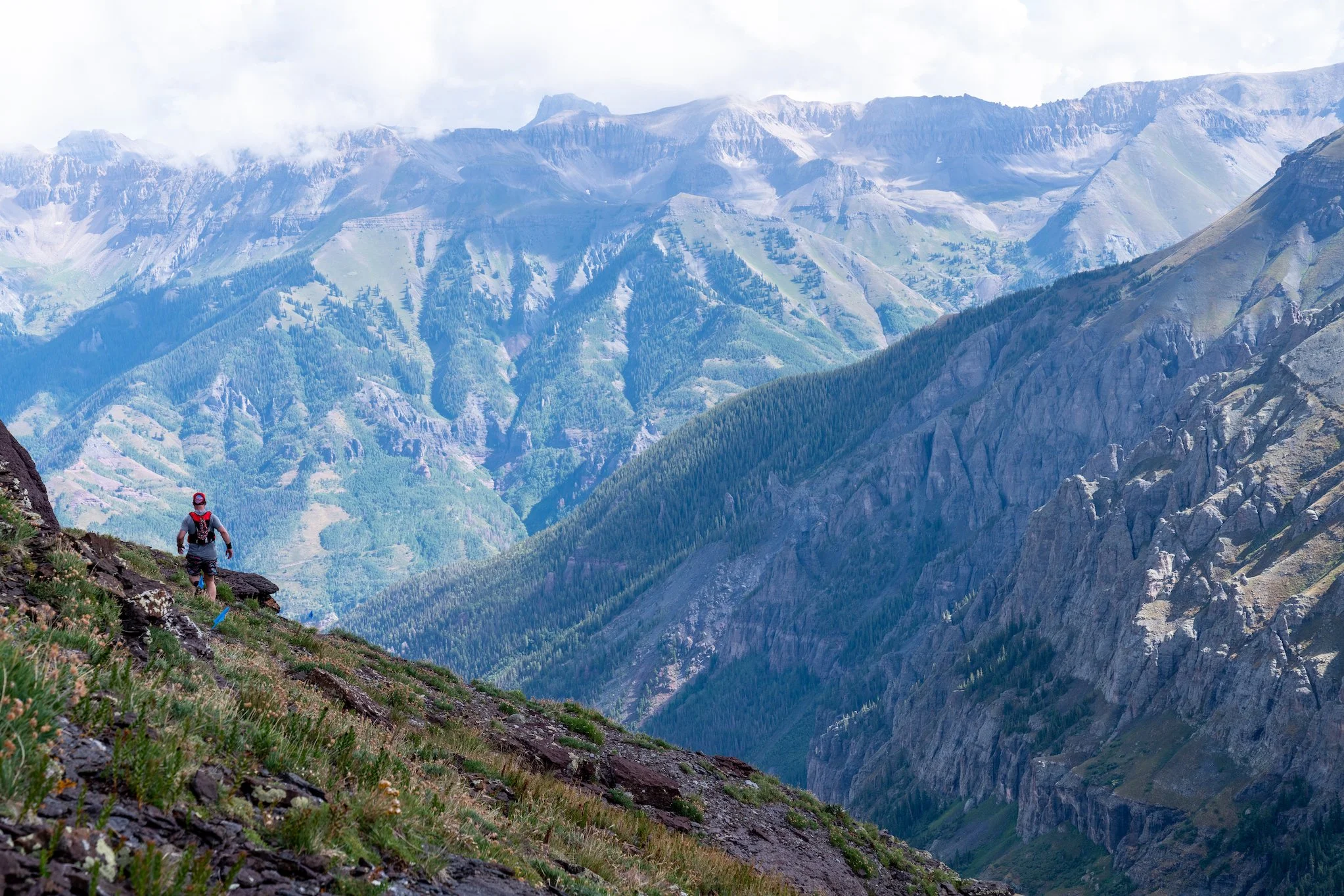
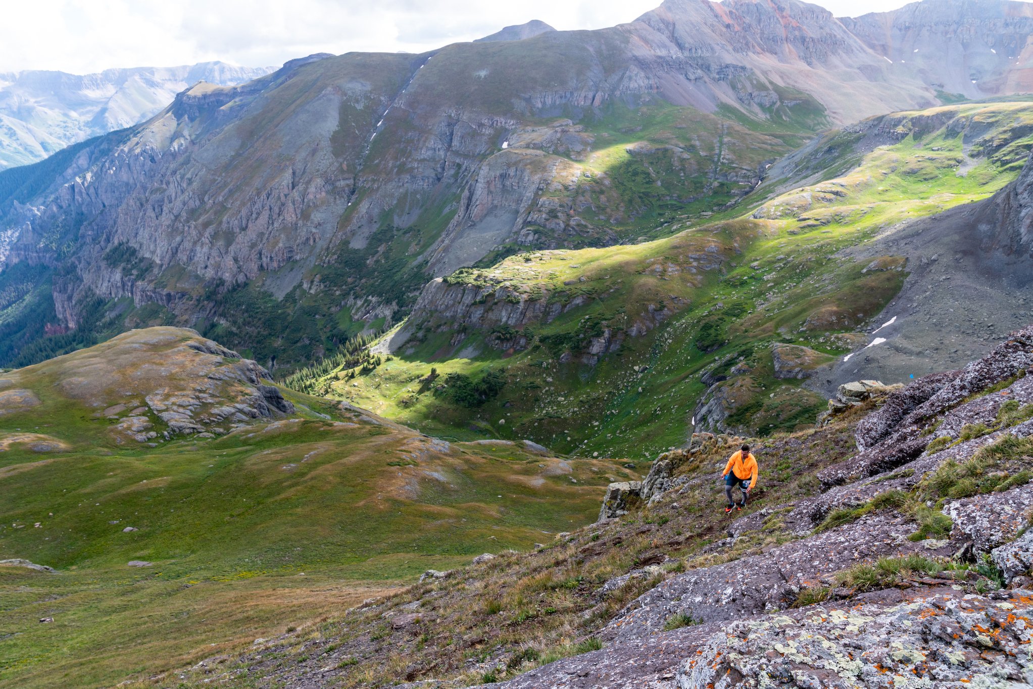
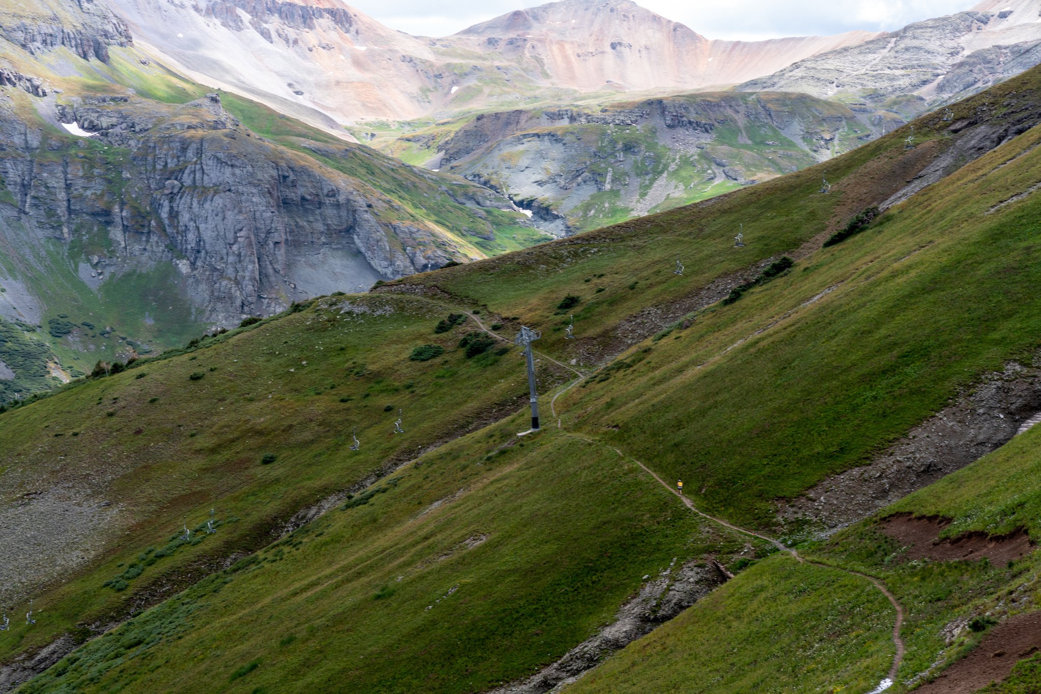
This course splits its mileage between the Telluride Ski Area and the West Fork of Bear Creek, climbing to a highpoint of 12,900ft on the Gold Hill ridge line from the town of Telluride. The course will cover a variety of terrain that includes jeep roads, forested single track, a high ridge traverse to the highpoint on Gold Hill and a stunning descent through grassy alpine basins. This course will work your lungs with 4,500ft of vertical gain in the first half of the course.
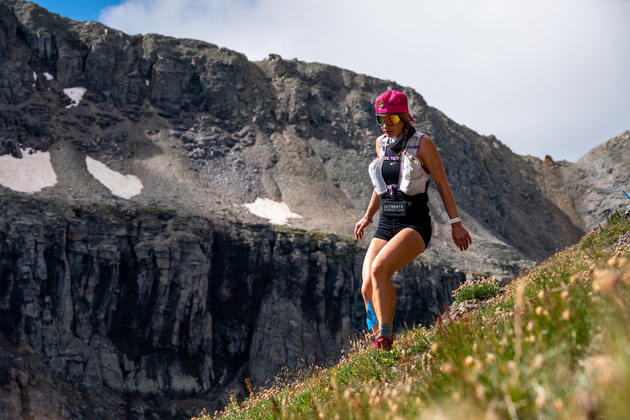
You should know... there are sections of this course that are technical, steep and loose. THIS IS A TECHNICAL MOUNTAIN RACE, NOT A TRAIL RUN- participants will be running to altitudes close to 13,000ft on exposed ridgelines and steep, rocky summits. The trails are extremely rocky and at times they can be hard to decipher. There are many sections of this course that will be exposed to falls, potential rockfall and hazardous weather. There will be safety personnel along sections of the route monitoring these hazards but all participants should be responsible for their own safety. THIS IS NOT AN EVENT FOR BEGINNERS

13 miler:
Distance: About 13 Miles (21K)
Start/Finish: Telluride Town Park
Elevation Gain: About 5,000 ft (1,550m)
Overall time limit: 8 hours
Number of Aid Stations: 2
Aid Stations and Cut Off times:
There will be two fully stocked aid station along the 13 mile course. The aid station will be stocked with water, electrolyte drink, sweet and salty snacks, first aid, and super nice volunteers!

*Cut-off times will be strictly enforced for the safety of the runners.
Drop Bags:
There will be no drop bags for the 13 mile race.
Spectating:
We encourage spectators to cheer on the runners along the course. There is no vehicle access to the public along the 13 mile course so spectators will need to hike. The gondola is free to the public and San Sophia Station provides easy access to start a hike. 13 mile runners will also pass through Bear Creek in the final miles of the race.
*We ask that spectators do not hike to the top of the Gold Hill ridge. The terrain is steep and loose and there is limited space for the runners and our safety personnel. Thanks.
Course Markings:
The course will be well marked with flagging tape, flags and at some intersections, directional signs. The race organizers will do everything they can to have the course well marked for race participants the day of the event. Runners must follow trail markings and not cut switchbacks. Please be sure to understand the course! This is super important- Despite all our efforts to mark the course really well, some of our route marking have gone missing every year.
Course Descriptions:
The 13 Mile course starts and ends in Telluride Town Park.
Section 1- Telluride to Gold Hill 1: Leave Telluride Town Park and head west on Pacific Street for two blocks. Turn left onto Pine Street and follow it to the Bear Creek Trailhead. Turn right onto Camels Garden Trail soon after starting up Bear Creek, Follow Camels Garden to the ski area and Telluride Trail. Follow Telluride Trail up for about half a mile until you have the option to continue straight on Easy Out Road. After .3 miles, Easy Out Road will take a right turn, follow this up for 1 mile to See Forever Ridge. If you miss this turn you will soon arrive at the base of Lift 9. Continue on the See Forever Trail (road), off and on the ridge, for 1.8 miles to the Gold Hill Aid Station- mile 4.2.
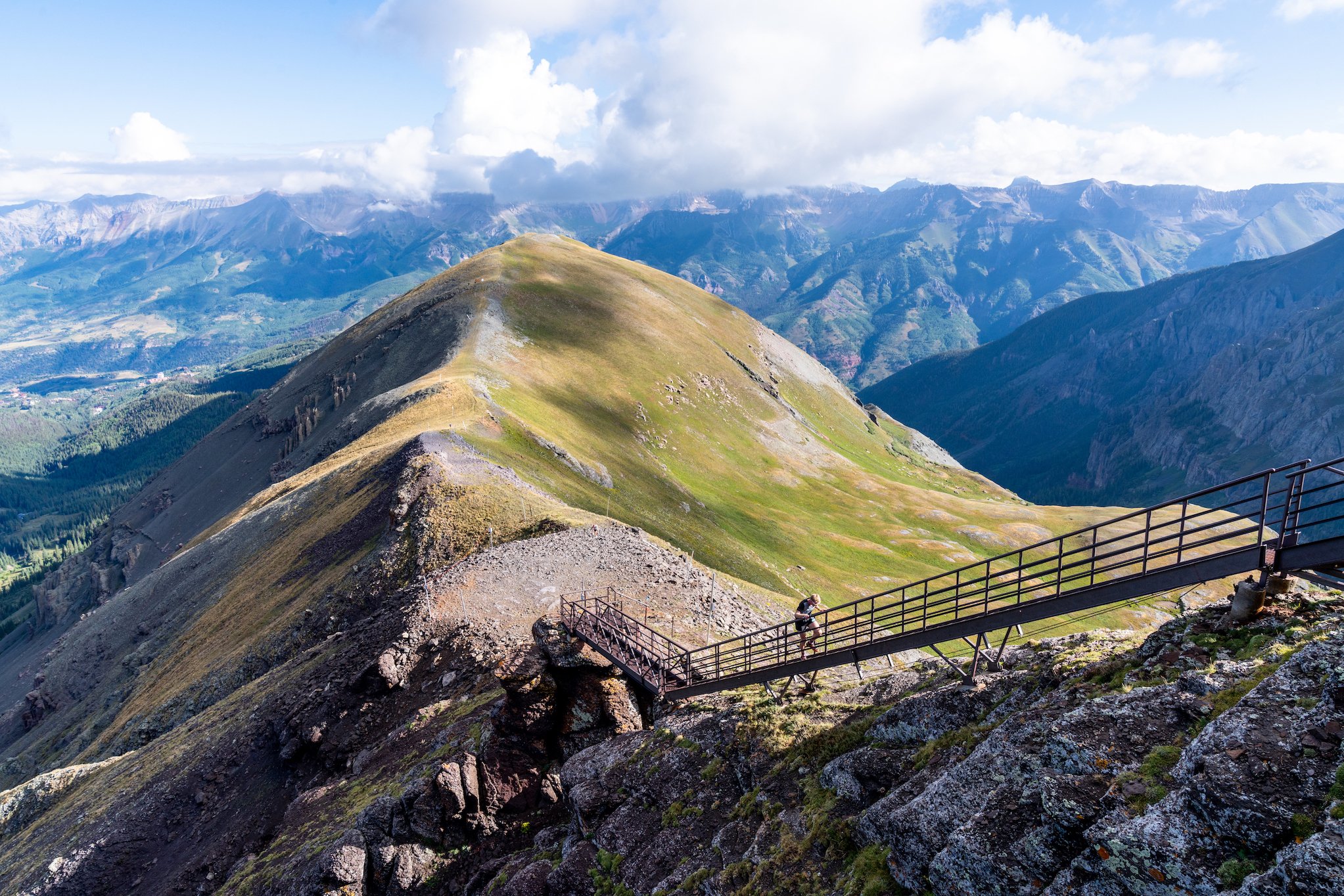
Section 2- Gold Hill 1 to Gold Hill Summit and back to Gold Hill 2: This section of the course has steep and loose travel to 12,900ft. From the Gold Hill 1 Aid Station continue up the road, past the top of Lift 15 for ~1 mile. You will encounter the Gold Hill staircase at this point. Take the stairs to the top and follow the signs looping you around the summit of the 13 mile course. You will then descend the staircase and follow the road back to Gold Hill 2 Aid Station- mile 6.5.
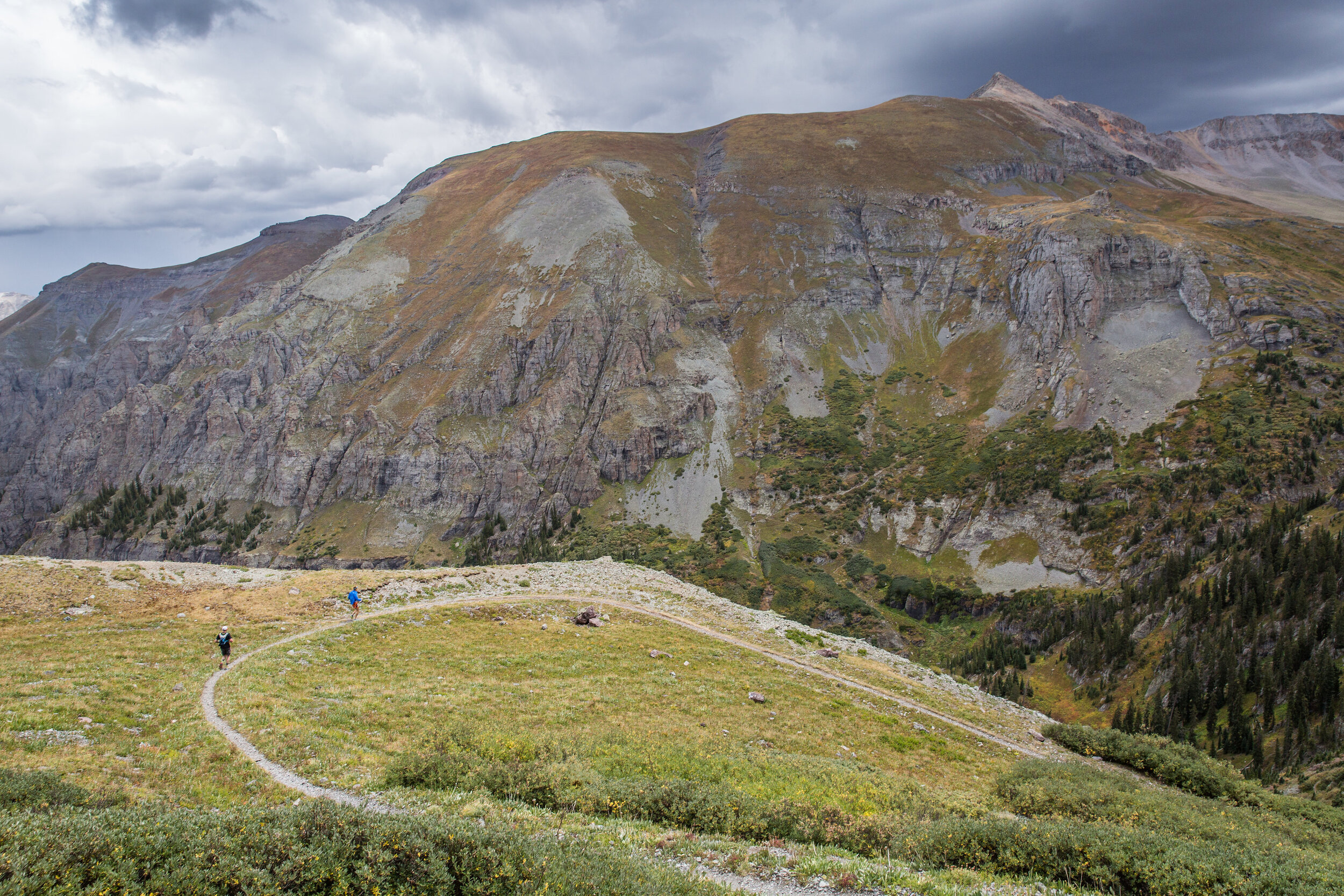
Section 3- Gold Hill 2 to East Fork of Bear Creek: Exit the Gold Hill 2 Aid Station and immediately take a hard right. The course winds underneath Lift 15 and you begin your descent into Bear Creek. Follow the beautiful Wasatch Connection trail through green and flowered alpine bowls. This single track trail is a mix of dirt and loose rock, watch your step. After 1.5 miles, take a right and start back uphill on the West Fork Trail. This .75 mile climb and traverse sends you through more alpine bowls and connects with the East Fork Trail.
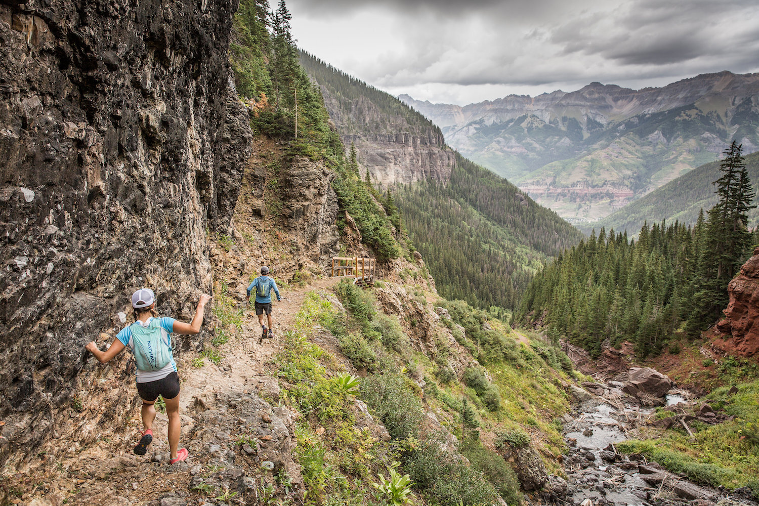
Section 4- East Fork of Bear Creek to Telluride: At the intersection, head left, downhill, and follow the East Fork Trail back towards Telluride. You will descend the East Fork Trail for 1 mile to where it intersects with the Wasatch Trail. Turn right (downhill) and follow the Wasatch Trail for 1.25 miles to the intersection with the Bear Creek Trail. Turn left (downhill) and run the wide and smooth Bear Creek Trail until it turns to asphalt in the Town of Telluride after 2 miles. Continue straight on Pine Street for ~500 ft. You will cross the San Miguel River and hang an immediate right on the River Trail. Continue for .25 miles and take your next right into Town Park across another bridge over the San Miguel river. At this point you are within .1 mile! Follow the signs to the Finish Line. DONE! EAT FOOD! DRINK BEER!