
40-Mile Course (64k)
We are currently working with the US Forest Service on an exciting new 40-mile course for 2026! We will share all of the new info once we have all of the details squared away.
SATURDAY, AUGUST 22, 2026 • 5:00AM START AT Telluride Town Park
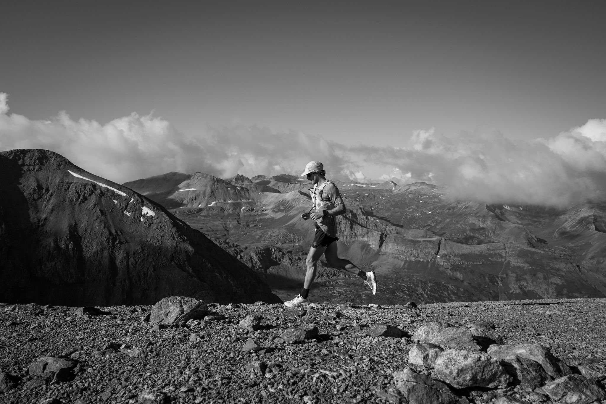
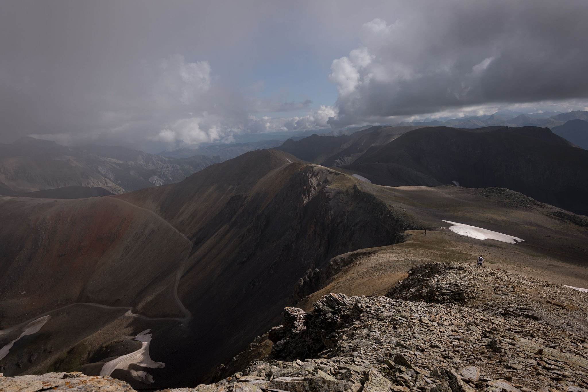
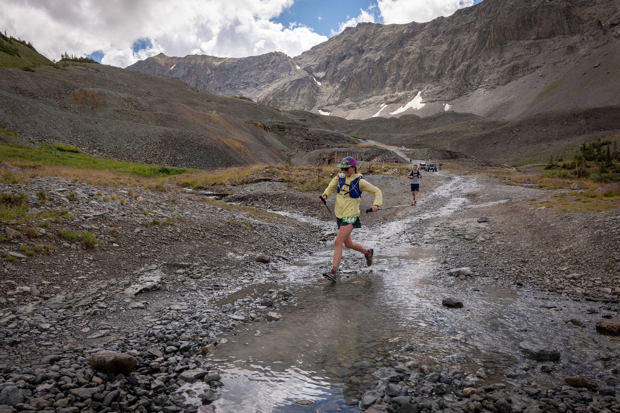
Incredibly similar to the original and infamous TMR route, this course capitalizes on the picturesque trail system surrounding the Telluride region while delivering almost 14,000ft of ascent/descent over 40 miles. In the words of race founder, Dakota Jones- "The course is really hard". We have retooled the course to minimize time running the dirt roads on the ski area and spending more time on single and doubletrack trails. You will go over 13,000 ft twice along with two additional climbs over 12,000 ft.
The course includes 1.5 miles of sharp ridgeline above 13,000 ft between Ajax Peak and Imogene Pass. Not to mention the 13,500 ft summit of Telluride Peak along the ridge. We call this section the "Mile and a Half of Sky". Prepare for difficult day in the mountains!
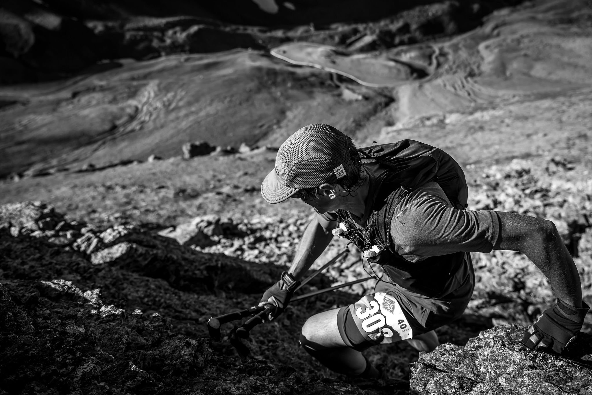
You should know... there are sections of this course that are extremely technical, steep and loose. THIS IS A TECHNICAL MOUNTAIN RACE, NOT A TRAIL RUN- participants will be running to altitudes of over 13,000 ft on exposed ridgelines and steep, rocky summits. The trails are extremely rocky and at times there are no trails at all. There are many sections of this course that will be exposed to falls, potential rockfall and hazardous weather. There will be safety personnel along sections of the route monitoring these hazards but all participants should be responsible for their own safety. THIS IS NOT AN EVENT FOR BEGINNERS

40 mile Route:
Distance: About 40 Miles (64K)
Start/Finish: Telluride Town Park
Elevation Gain: About 14,000 ft (4,250m)
Overall time limit: 15 hours
Number of Aid Stations: 5

Aid Stations and Cut Off times:
There will be five fully stocked aid stations along the 40 mile course. All aid stations will be stocked with water, electrolyte drink, sweet and salty snacks, first aid, and super nice volunteers!

*Cut-off times will be strictly enforced for the safety of the runners.
40 mile Drop Bags:
40 mile runners will be allowed to have two drop bags- Bridal Veil (Mile 11) and Mill Creek (Mile 29). Please mark all drop bags with your bib number and bring them to the starting line on Saturday morning. There will be a designated drop spot for each aid station.
Spectating:
We encourage spectators to cheer on the runners along the course. However, most of the aid stations that are accessible by vehicles have very limited parking. If you would like to visit the Bridal Veil aid station please park at the bottom of the road and hike to the station. The hike to the Bridal Veil Station is roughly a two miles and passes the iconic Bridal Veil Falls. Mill Creek Station is very accessible by vehicle but has limited parking.
Course Markings:
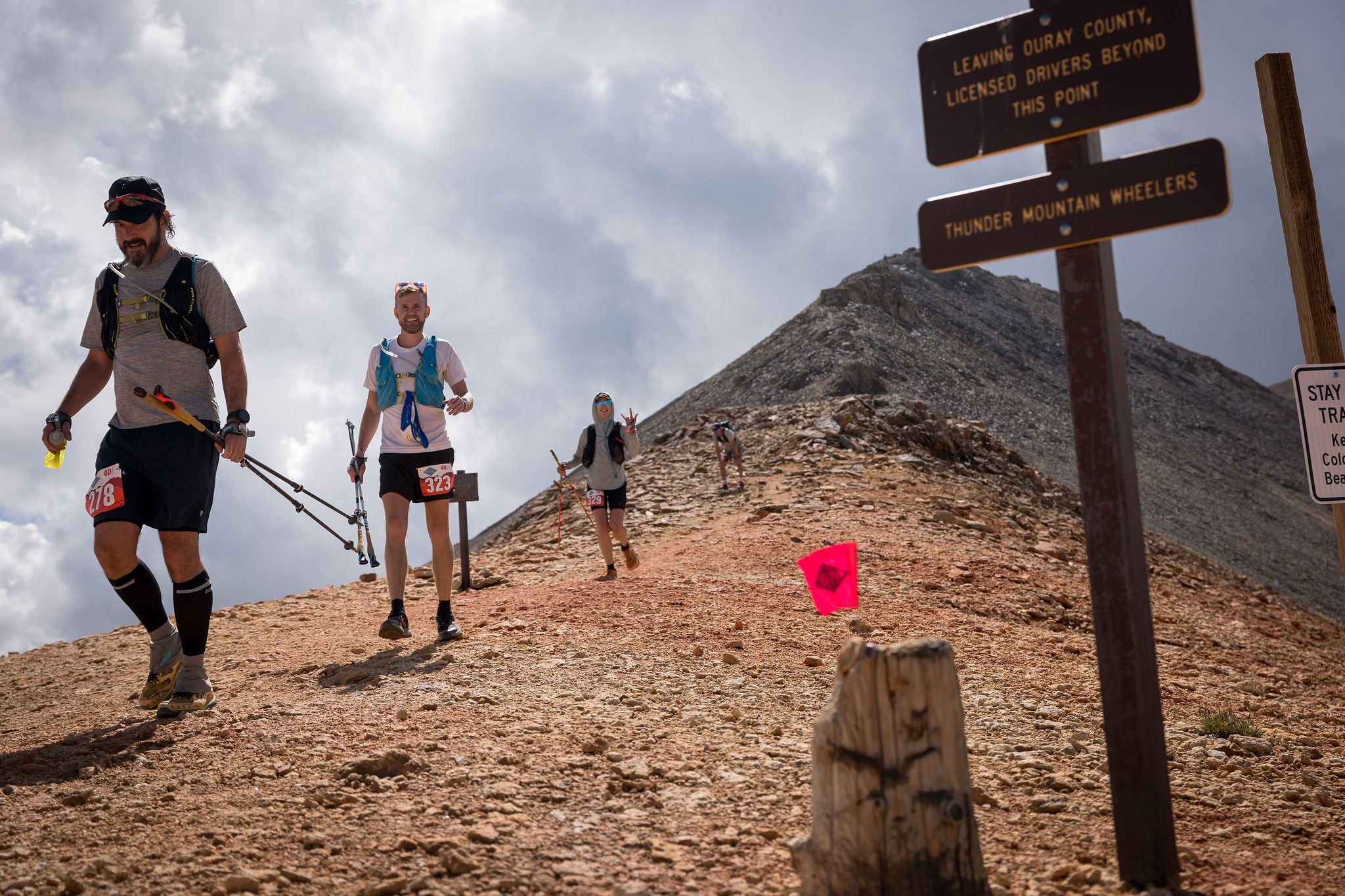
The course will be well marked with flagging tape, flags and at some intersections, directional signs. The race organizers will do everything they can to have the course well marked for race participants the day of the event. Runners must follow trail markings and not cut switchbacks. Please be sure to understand the course! This is super important- Despite all our efforts to mark the course really well, some of our route marking have gone missing every year.
Route Description:
The 40 Mile course starts and ends in Telluride Town Park.
Section 1- Telluride to Bridal Veil: Leave Telluride Town Park and head west on Pacific Street for two blocks. Turn left onto Pine Street and follow it to the Bear Creek Trailhead. Follow the Bear Creek double track up for 2 miles to the Wasatch Trail intersection. Take a right turn up the Wasatch Trail and continue for 1 mile and veer left onto the East Fork Trail. Follow the East Fork Bear Creek Trail up for 1.2 miles where the trail will merge with the Wasatch Trail. Continue up and left for 1.5 miles to Wasatch Pass. From Wasatch Pass head down and left on a faint two track road marked with large rock cairns. After roughly .5 miles on this road there will be a hard right turn down hill marked with a new(ish) Forest Service sign. Follow this (Bridal Veil Road) down for roughly 4 miles to the Bridal Veil Aid Station- mile 11.
Section 2- Bridal Veil to Tomboy: From the Bridal Veil Aid Station continue up the Black Bear Pass Road switchbacks for 1.2 miles before taking a left turn onto the Ajax Peak Trail. This will be shortly after a steep rock step in the road following the river crossing above Ingram Falls. Follow the Ajax Trail for 1.5 miles of switchbacks to the ridge. From the ridge continue up and right on rocky terrain for .3 miles to the summit of Peak 13,230. From the summit of Peak 13,230, turn left (east) and follow the high ridge for 1.5 miles, passing over the summit of Telluride Peak (13,509'), to Imogene Pass at 13,200'. From Imogene Pass head down Tomboy Road for 1.5 miles to the Tomboy Aid Station- mile 16.5. ***Note- The route more or less follows the direct ridgeline with a few deviations dropping off to the right side for less technical terrain. There are sections of this ridge that a very loose so please take your time and be aware of others below you. It is also very exposed to weather so please use your best judgement on whether or not to proceed if storms appear to be moving in- this 1.5 miles will be very slow for most runners.
Section 3- Imogene to Liberty Bell: Continue down Tomboy Road for 1 mile and take a right turn on the Marshall Basin Road- this will appear shortly after you exit the old Tomboy town ruins. Follow the Marshall Basin Road to the upper mining ruins and continue up grassy slopes to the right until you are able to regain a single track trail heading back left towards Mendota Pass- 2.2 miles from the start of the road. *Note- If you continue up and right on this single track, instead of left, it will take you to Virginius Pass- do not go this way! Head down the steep loose trail from Mendota Pass. Once back on the tundra the trail will fork, take the faint trail to the right which will send you to the Liberty Bell Trail. From Mendota Pass, it is 2.6 miles to the Liberty Bell Aid Station- mile 22
Section 4- Liberty Bell to Mill Creek: From the Liberty Bell Aid Station turn right (north) on the Jud Wiebe Trail. Follow this for 1.3 miles to a right turn at the Deep Creek/ Mill Creek Trail sign. This is part way down the Jud Wiebe descent. * Note- flagging has been repeatedly removed from this intersection. If you miss this turn and continue straight you will soon arrive back in town at the top of Aspen street, turn around and go back up to the Deep Creek/ Mill Creek intersection. About 100 yards after making the turn you will encounter another intersection- stay left on the Deep Creek/ Mill Creek Trail. Follow the Mill Creek Trail for a relatively flat 2 miles. Shortly after crossing the bridge take a right turn and head up the Deep Creek Trail. * Note- flagging has been repeatedly removed from this intersection. If you miss this turn and continue straight you will soon arrive at the Deep Creek Trailhead on Mill Creek Road, turn around and go back up to the Deep Creek intersection. Follow the Deep Creek Trail for 1.5 miles to the top of the hill, continue straight and down for .6 miles to the Eider Creek Trail intersection- turn down and left. * Note- flagging has been repeatedly removed from this intersection. If you miss this left turn you will continue contouring the mountain side for another 5 miles before hitting the Deep Creek Trailhead on Last Dollar Road- Do not miss this left turn down Eider Creek. Continue down Eider Creek Trail for 1.7 miles to the intersection with Mill Creek Road. From the Mill Creek Road intersection run down the Mill Creek Road for .5 miles to the valley floor and the Mill Creek Station. Mile 29.
Section 5- Mill Creek to Gold Hill: From the Mill Creek Station take a left on the paved bike trail for 100 yard and cross the Spur Road (highway) just past the Shell gas station. Continue another .5 miles across the valley floor. After you cross the San Miguel River take a left and run along the “river trail” for 1 mile. Once you enter the town of Telluride take a left on Mahoney Drive, immediately cross the bridge and take a right on the river trail continuation (the trail just switches river banks). Continue for .1 mile and take a right into the Carhenge Parking Lot. Gear up for one last grueling climb! Follow the ski area access road from the SW corner of the parking lot. Follow Telluride Trail up for 1 mile until you have the option to continue straight on Easy Out Road. After .3 miles, Easy Out Road will take a right turn, follow this up for 1 mile to See Forever Ridge. If you miss this turn you will soon arrive at the base of Lift 9. Continue on the See Forever Trail (road), off and on the ridge, for 1.8 miles to the Gold Hill Aid Station- mile 35.
Section 6- Gold Hill to Finish (Almost There): From the Gold Hill Aid Station take an immediate left onto the contouring single track (Wasatch Connect Trail) that passes underneath Chairlift 15. Follow the Wasatch Connect Trail down for 3.5 miles to the intersection with Bear Creek Trail. Turn left (downhill) and run the wide and smooth Bear Creek Trail until it turns to asphalt in the Town of Telluride after 2 miles. Continue straight on Pine Street for ~500 ft. You will cross the San Miguel River and hang an immediate right on the River Trail. Continue for .25 miles and take your next right into Town Park across another bridge over the San Miguel river. At this point you are within .1 mile! Follow the signs to the Finish Line. DONE! EAT FOOD! DRINK BEER