
24-Mile Course (38k)
SATURDAY, AUGUST 22, 2026 • 5:30AM START AT Telluride Town Park)
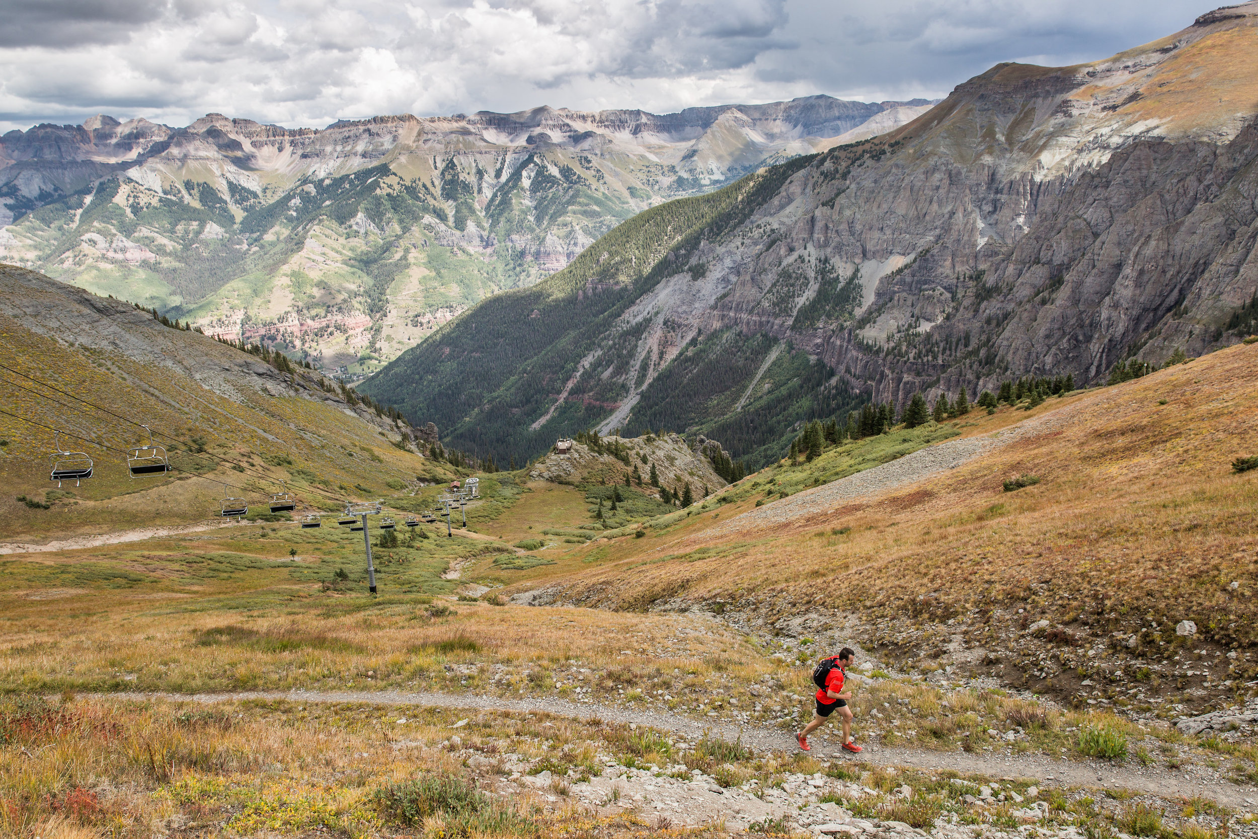
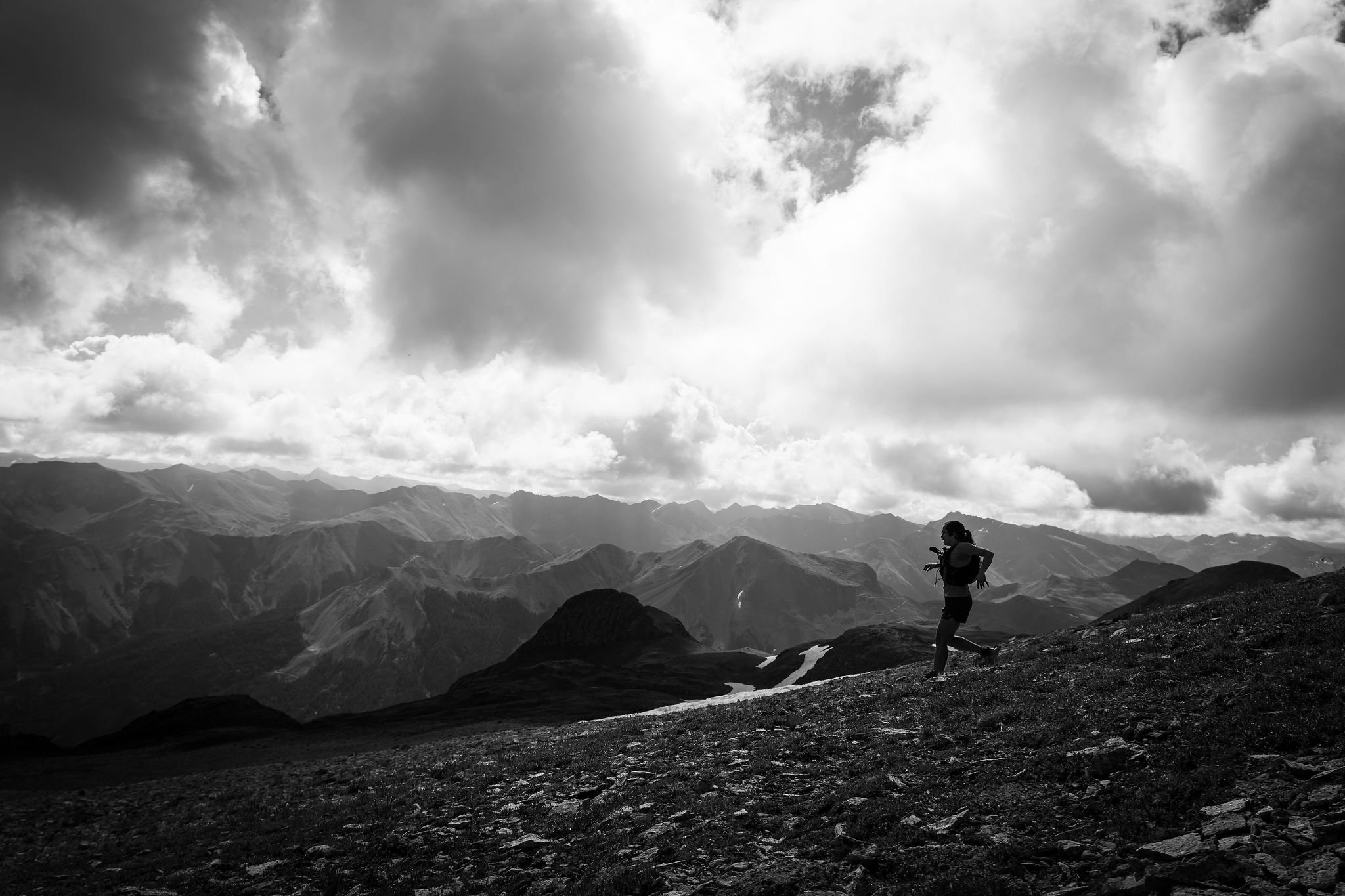
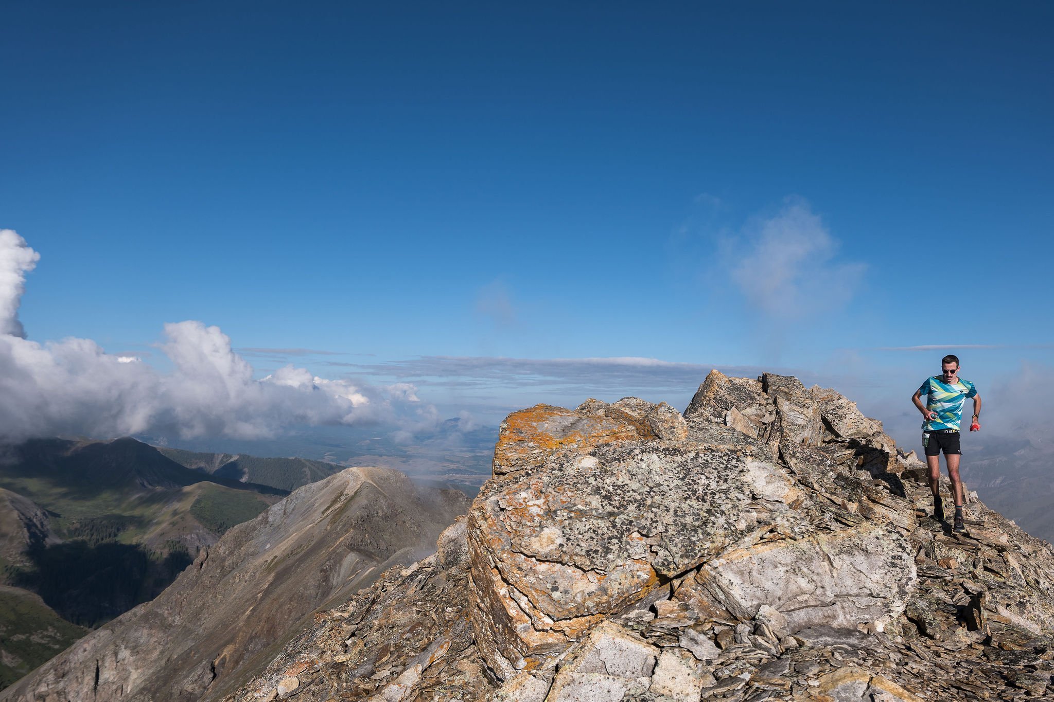
The 24-mile course incorporates some of our favorite sections of trail from the 40 mile course. The course takes you through the lush and forested Bear Creek Preserve, across the stunning ridge traverse from Ajax Peak to Telluride Peak and even gives you a taste of history as you run through the abandoned mining town of Tomboy. The course will cover a variety of terrain that includes jeep roads, forested single track, amazing alpine single and double track, and a loose and rocky high ridge traverse to Telluride Peak. You will spend the majority of the race running above 10,000ft and you will summit peaks over 13,000 ft twice. With a little bit of everything this is a great mountain running challenge for those not wanting to tackle the 40 miler.
You should know... there are sections of this course that are extremely technical, steep and loose. THIS IS A TECHNICAL MOUNTAIN RACE, NOT A TRAIL RUN- participants will be running to altitudes of over 13,000 ft on exposed ridgelines and steep, rocky summits. The trails are extremely rocky and at times there are no trails at all. There are many sections of this course that will be exposed to falls, potential rockfall and hazardous weather. There will be safety personnel along sections of the route monitoring these hazards but all participants should be responsible for their own safety. THIS IS NOT AN EVENT FOR BEGINNERS.

24 MILER:
Distance: About 24 Miles (38K)
Start/Finish: Telluride Town Park
Elevation Gain: About 9,000 ft (2,835m)
Overall time limit: 10.5 hours
Number of Aid Stations: 4
Aid Stations and Cut Off times:
There will be three fully stocked aid stations along the 24 mile course. All aid stations will be stocked with water, electrolyte drink, sweet and salty snacks, first aid, and super nice volunteers!
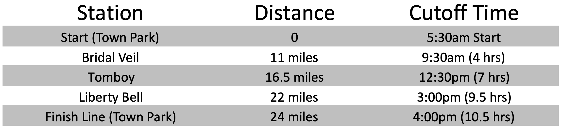
*Cut-off times will be strictly enforced for the safety of the runners.
Drop Bags:
There will be no drop bags for the 24 mile race.
Spectating:
We encourage spectators to cheer on the runners along the course. However, most of the aid stations that are accessible by vehicles have very limited parking. If you would like to visit the Bridal Veil aid station please park at the bottom of the road and hike to the station. The hike to the Bridal Veil Station is roughly two miles and passes the iconic Bridal Veil Falls.
Course Markings:
The course will be well marked with flagging tape, flags and at some intersections, directional signs. The race organizers will do everything they can to have the course well marked for race participants the day of the event. Runners must follow trail markings and not cut switchbacks. Please be sure to understand the course! This is super important- Despite all our efforts to mark the course really well, some of our route marking have gone missing every year.
Route Description:
The 24 Mile course starts and ends in the Telluride Town Park.
Section 1- Telluride to Bridal Veil: Leave Telluride Town Park and head west on Pacific Street for two blocks. Turn left onto Pine Street and follow it to the Bear Creek Trailhead. Follow the Bear Creek double track up for 2 miles to the Wasatch Trail intersection. Take a right turn up the Wasatch Trail and continue for 1 mile and veer left onto the East Fork Trail. Follow the East Fork Bear Creek Trail up for 1.2 miles where the trail will merge with the Wasatch Trail. Continue up and left for 1.5 miles to Wasatch Pass. From Wasatch Pass head down and left on a faint two track road marked with large rock cairns. After roughly .5 miles on this road there will be a hard right turn down hill marked with a new(ish) Forest Service sign. Follow this (Bridal Veil Road) down for roughly 4 miles to the Bridal Veil Aid Station- mile 11.
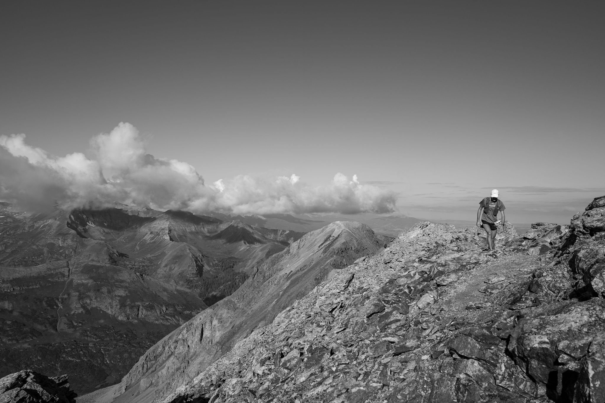
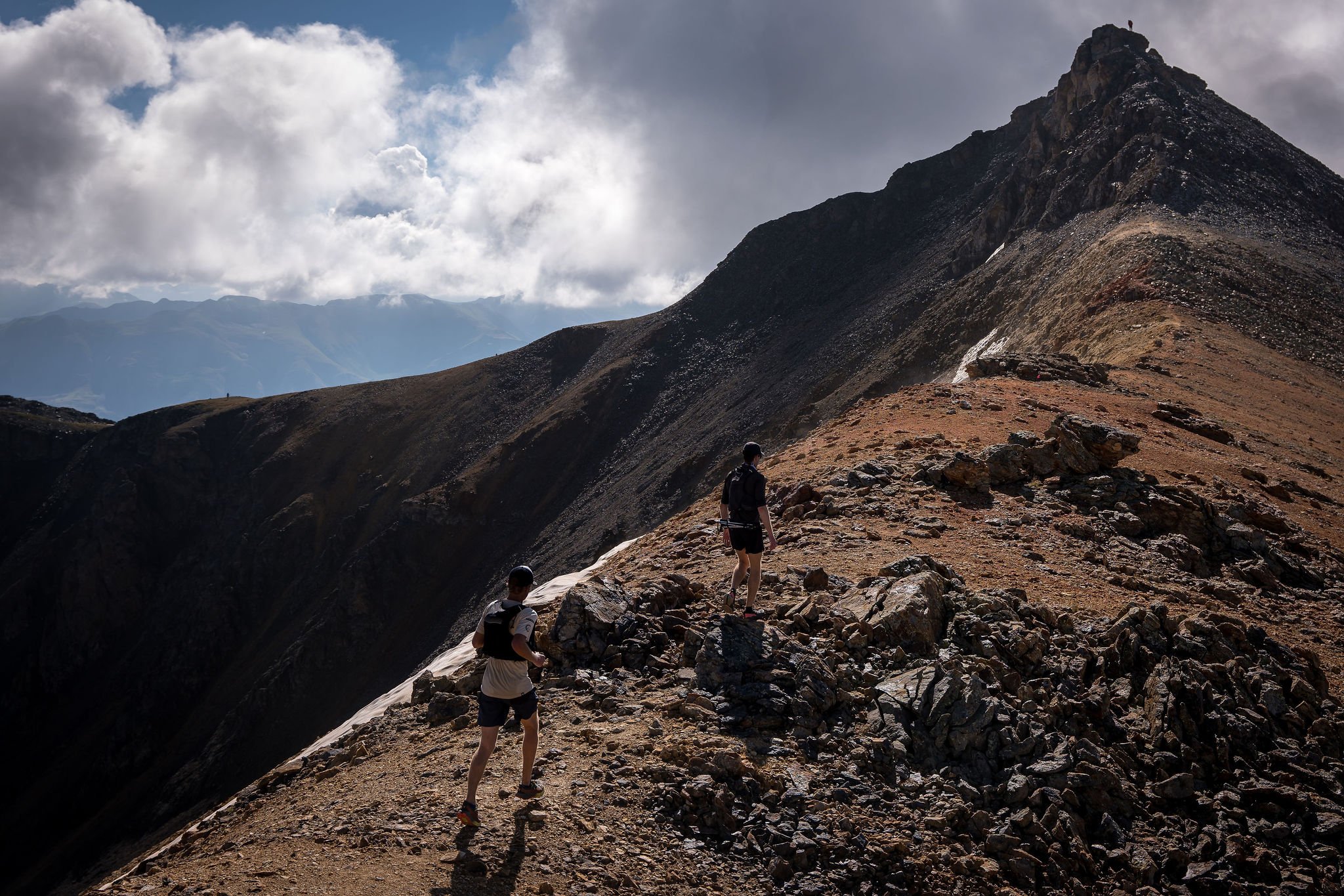
Section 2- Bridal Veil to Tomboy: From the Bridal Veil Aid Station continue up the Black Bear Pass Road switchbacks for 1.2 miles before taking a left turn onto the Ajax Peak Trail. This will be shortly after a steep rock step in the road following the river crossing above Ingram Falls. Follow the Ajax Trail for 1.5 miles of switchbacks to the ridge. From the ridge continue up and right on rocky terrain for .3 miles to the summit of Peak 13,230. From the summit of Peak 13,230, turn left (east) and follow the high ridge for 1.5 miles, passing over the summit of Telluride Peak (13,509'), to Imogene Pass at 13,200'. From Imogene Pass head down Tomboy Road for 1.5 miles to the Tomboy Aid Station- mile 16.5. ***Note- The route more or less follows the direct ridgeline with a few deviations dropping off to the right side for less technical terrain. There are sections of this ridge that a very loose so please take your time and be aware of others below you. It is also very exposed to weather so please use your best judgement on whether or not to proceed if storms appear to be moving in- this 1.5 miles will be very slow for most runners.
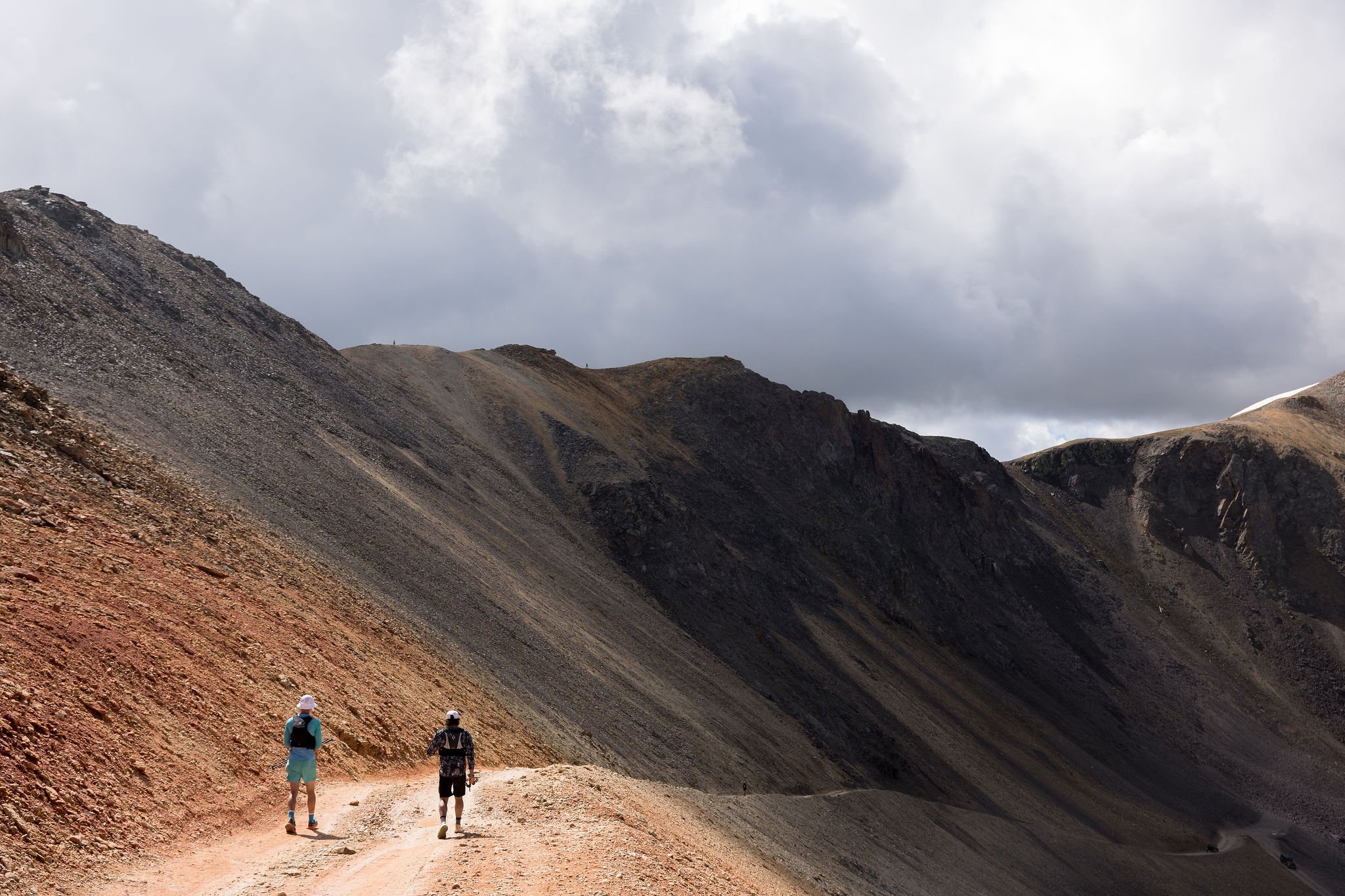
Section 3- Imogene to Liberty Bell: Continue down Tomboy Road for 1 mile and take a right turn on the Marshall Basin Road- this will appear shortly after you exit the old Tomboy town ruins. Follow the Marshall Basin Road to the upper mining ruins and continue up grassy slopes to the right until you are able to regain a single track trail heading back left towards Mendota Pass- 2.2 miles from the start of the road. *Note- If you continue up and right on this single track, instead of left, it will take you to Virginius Pass- do not go this way! Head down the steep loose trail from Mendota Pass. Once back on the tundra the trail will fork, take the faint trail to the right which will send you to the Liberty Bell Trail. From Mendota Pass, it is 2.6 miles to the Liberty Bell Aid Station- mile 22
Section 4- Liberty Bell to Telluride Town Park: From the Liberty Bell Aid Station, continue South down the Jud Wiebie Trail doubletrack towards Tomboy Road. *Note- if you turn right (west) onto the Jud Wiebie Trail single track you will drastically extend your race.
After 1 mile, take a right turn on Tomboy Road and run until you intersect pavement on Oak Street. Descend Oak Street one block and take a left (east) turn on Galena. Run 4 blocks on Galena Street and turn right (south) on Willow Street. Run three blocks south, be careful crossing Main Street. Turn left on Pacific Street, next to the post office, and enter Town Park. Follow signs to Finish Line!