65-Mile Run- New for 2026!
SATURDAY, AUGUST 22, 2026 • 6:00AM START AT Telluride Town Park
Mandatory safety meeting at 5:00pm, Friday, August 21.
*The 65-mile run is an advanced level run and a certain amount of technical mountain ultra-running experience is needed to register. Please see the REQUIREMENTS FOR APPROVAL.
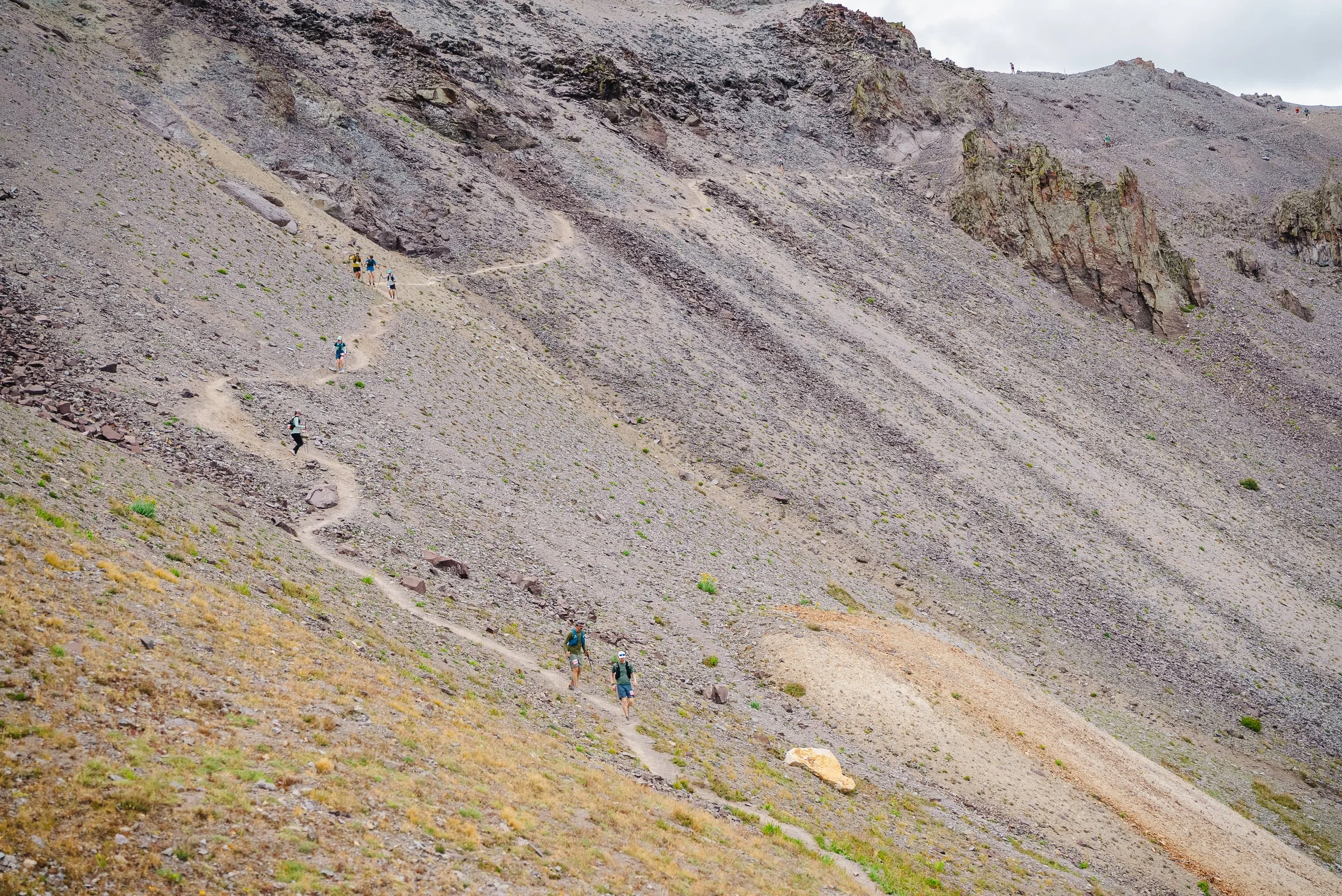
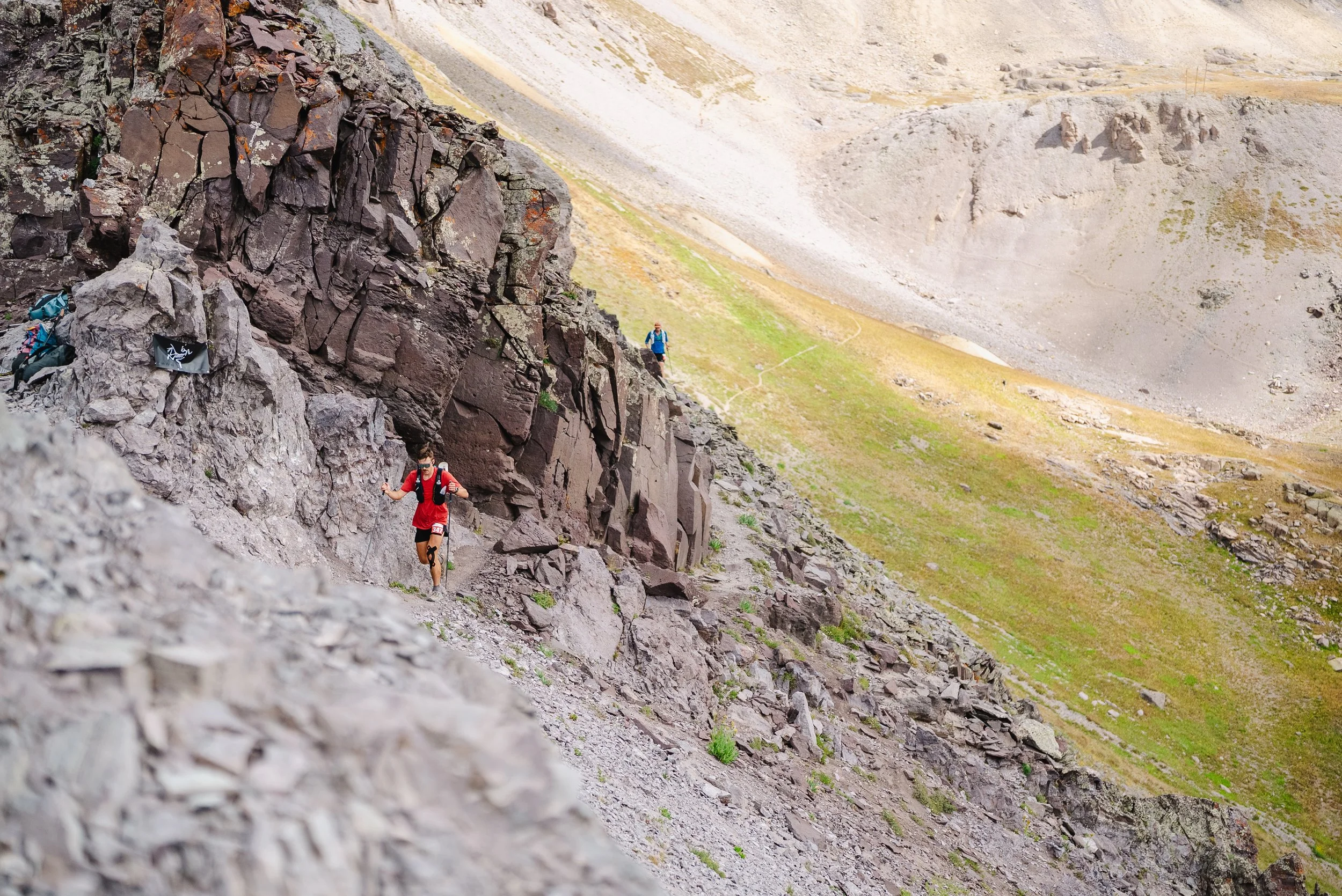
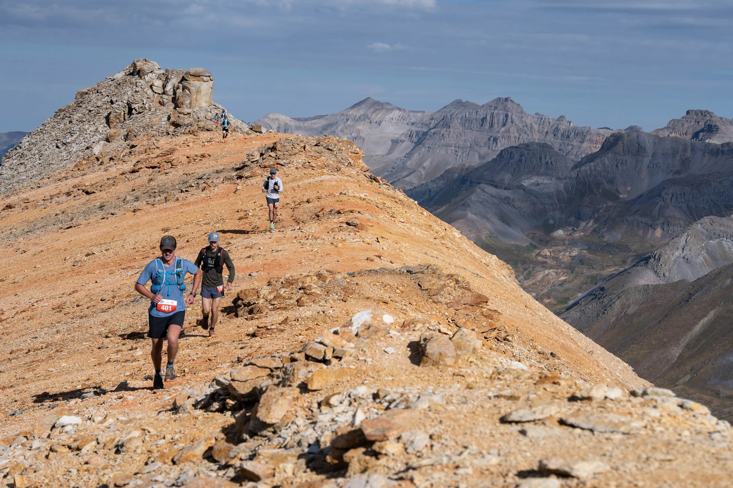
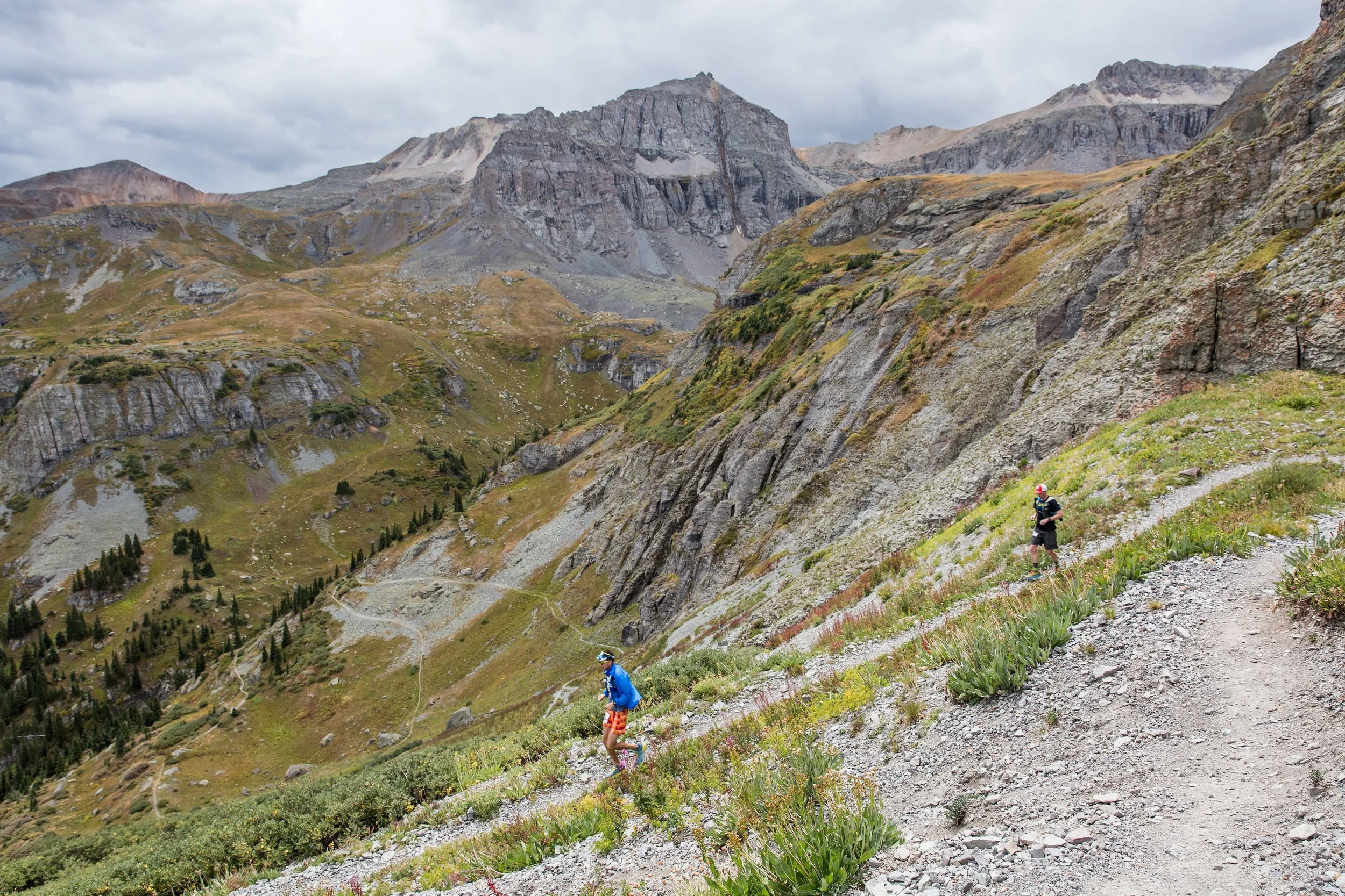
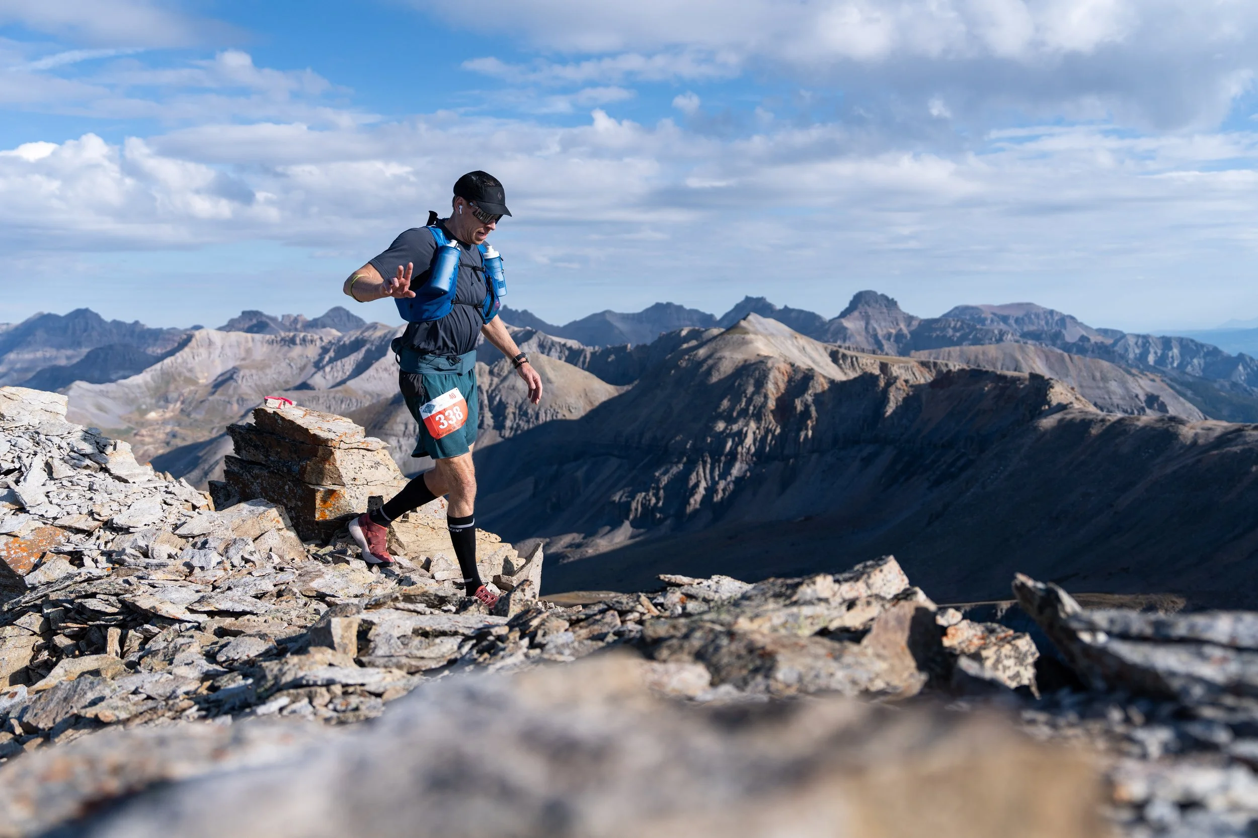
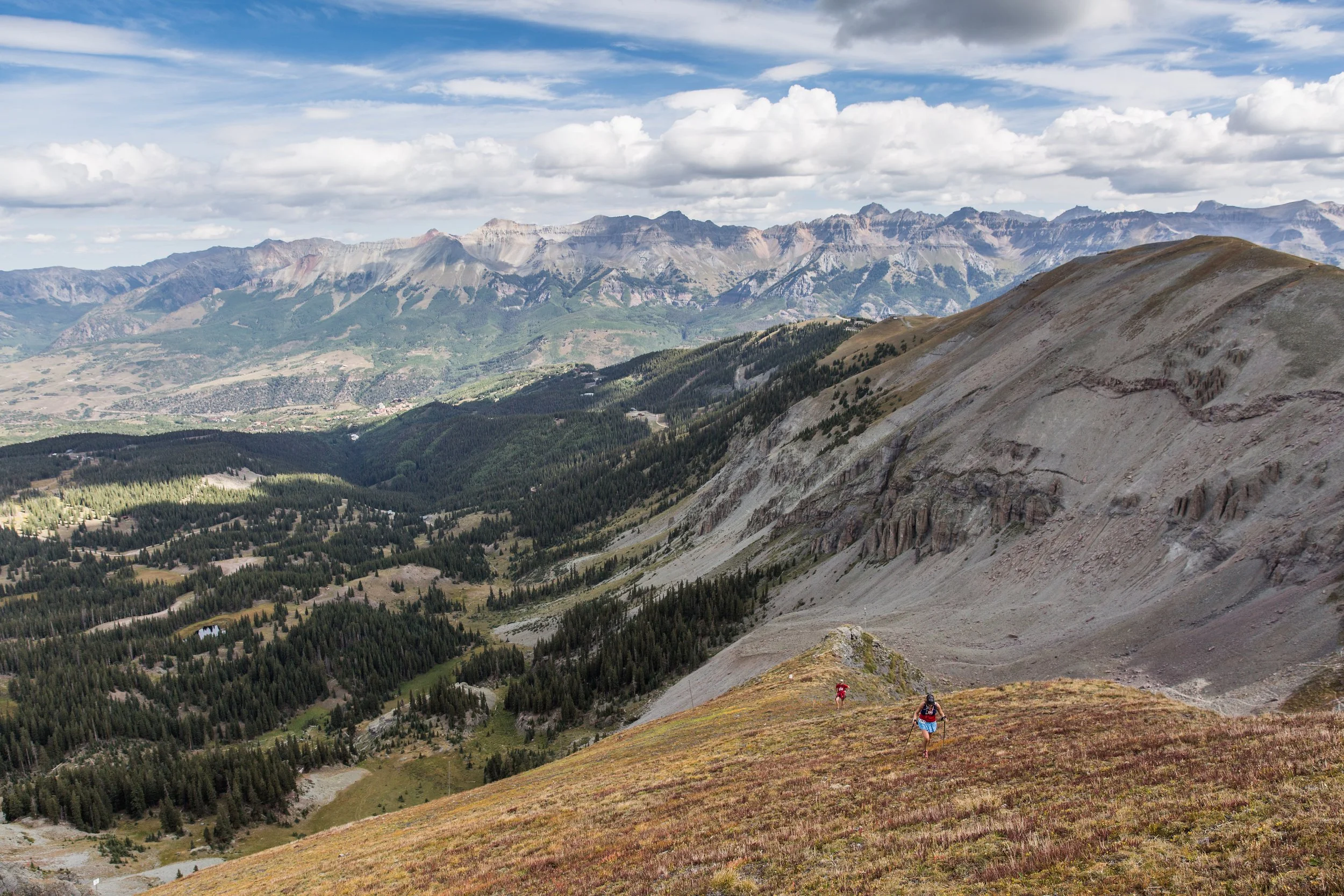
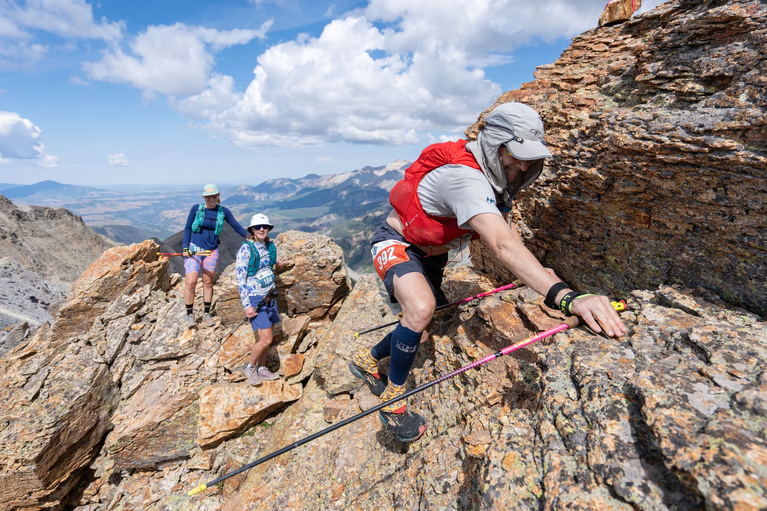
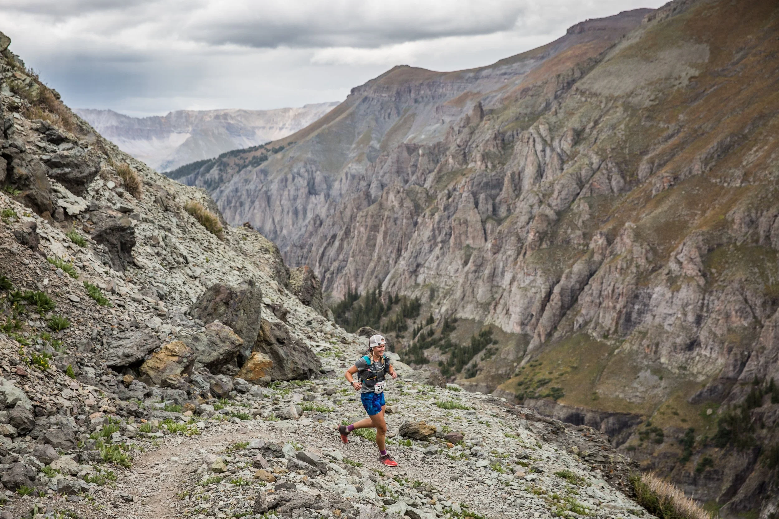
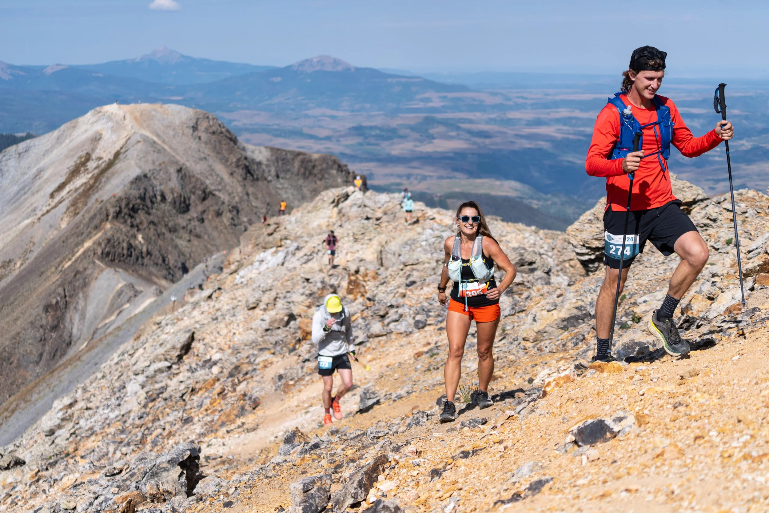
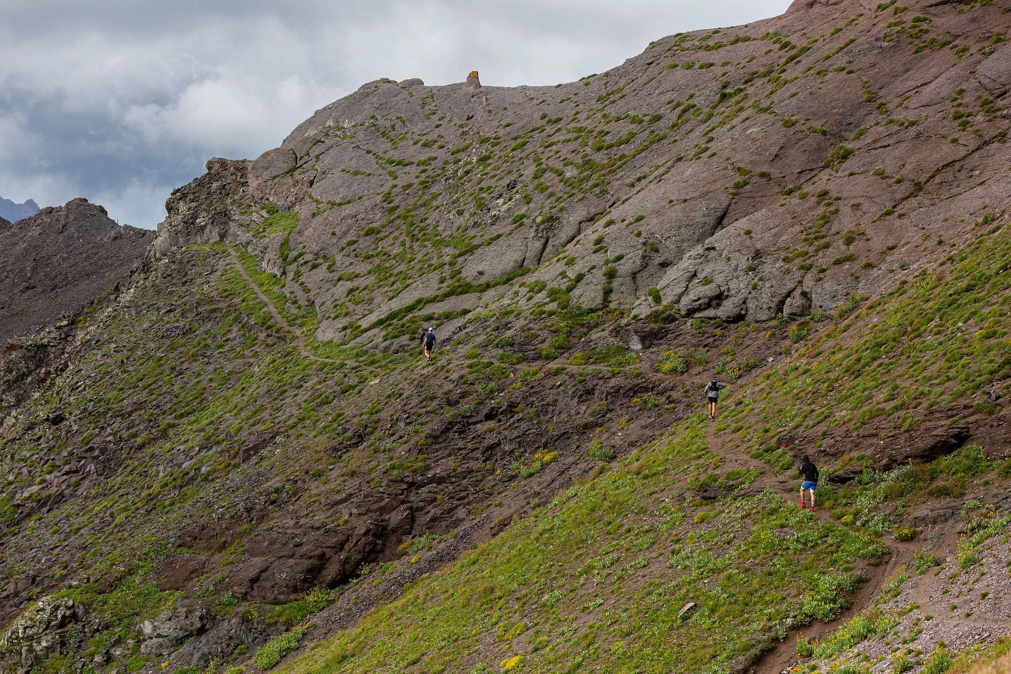
You should know... there are sections of this course that are technical, steep, and loose. THIS IS A TECHNICAL MOUNTAIN RACE, NOT A TRAIL RUN- participants will be running to altitudes above 13,000ft on exposed ridgelines and steep, rocky summits. The trails are extremely rocky and at times they can be hard to decipher. There are many sections of this course that will be exposed to falls, potential rockfall, and hazardous weather. There will be safety personnel along sections of the route monitoring these hazards but all participants should be responsible for their own safety. THIS IS NOT AN EVENT FOR BEGINNERS. EXPERIENCE IS REQUIRED.
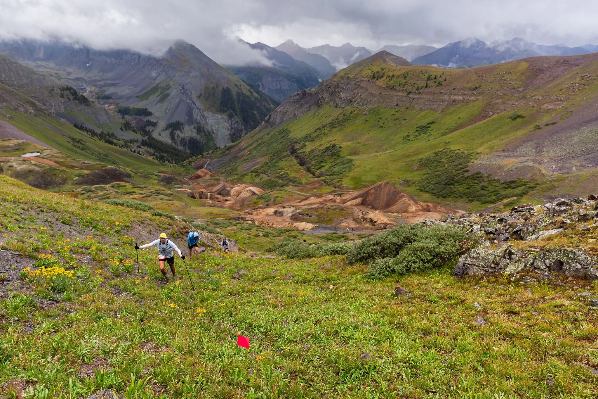
New ultra-distance run for 2026. The 65-mile run will be a challenging one! The first half of the course will run all of the same technical terrain covered in the 40-mile run but in a slightly different order. The second half of the run will cover entirely new terrain on a tour of local area passes that includes Black Bear Pass, Brooklyn Pass, Ophir Pass, and finally Oscar’s Pass before descending down through Wasatch Basin and Bear Creek to the finish line in Telluride.
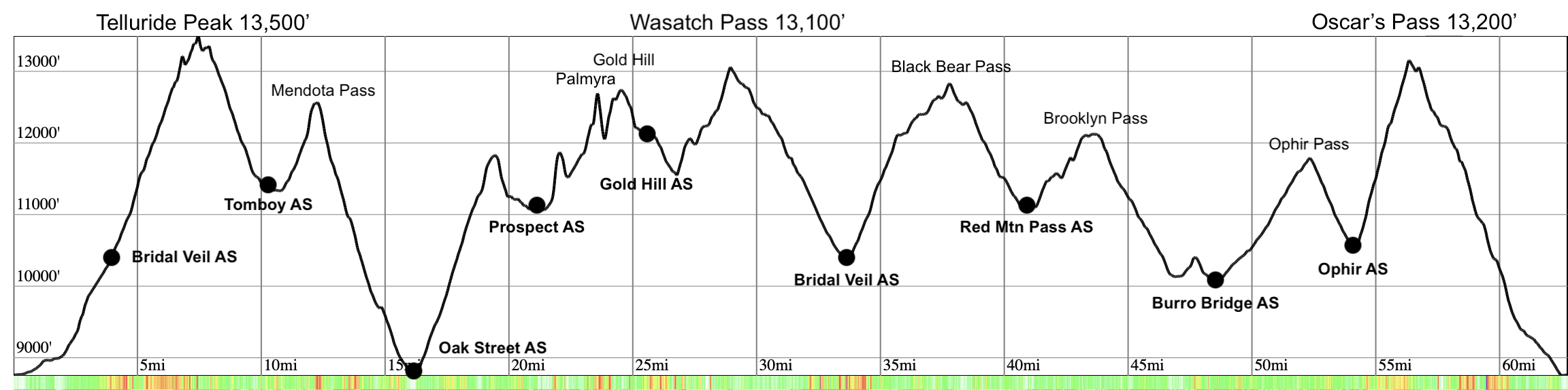
The run will spend the majority of the time above 10,000 ft and will travel across 1.5 miles of sharp, exposed ridgeline above 13,000 ft between Ajax Peak and Imogene Pass that includes the summit of Telluride Peak, 13,500’, along the way. We call this section the "Mile and a Half of Sky". The course will ascend above 13,000 ft a total of three separate times with seven additional climbs above 12,000 ft. Prepare for a challenging day in the San Juans!
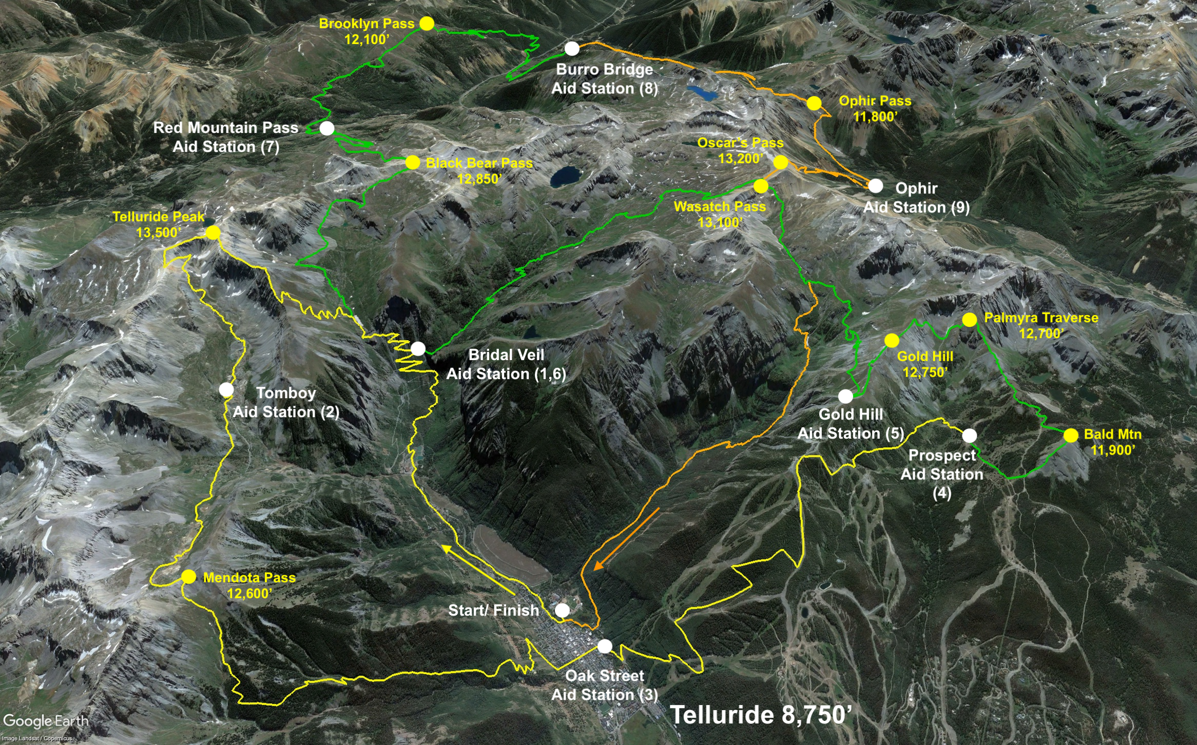
65-mile Route:
Distance: About 65 Miles (105km)
Start/Finish: Telluride Town Park
Elevation Gain: About 22,500 ft (6,850m)
Overall time limit: 32 hours
Number of Aid Stations: 9
*Distance, elevation gain, and GPX will be confirmed later this summer (2026).
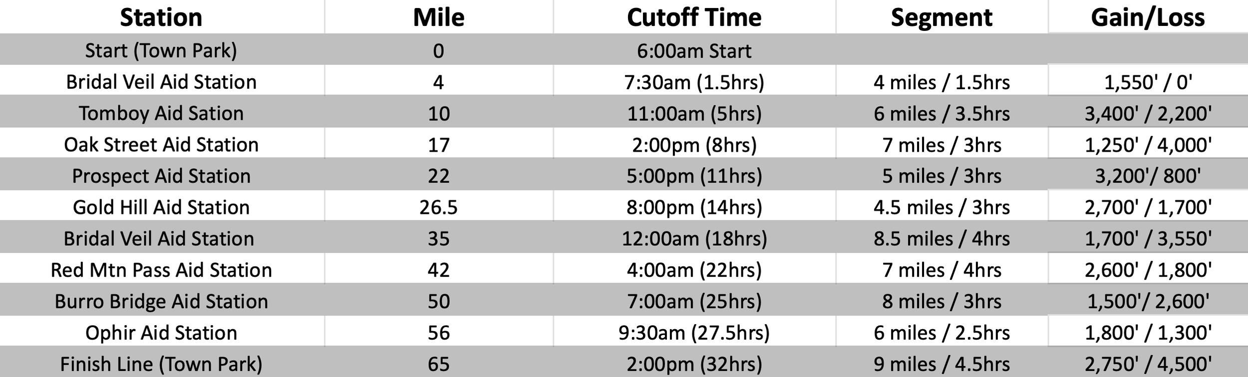
Aid Stations and Cut Off times:
TMR is a CUPLESS race. please bring your own reusable cup if you plan to drink at the aid stations and finish line.
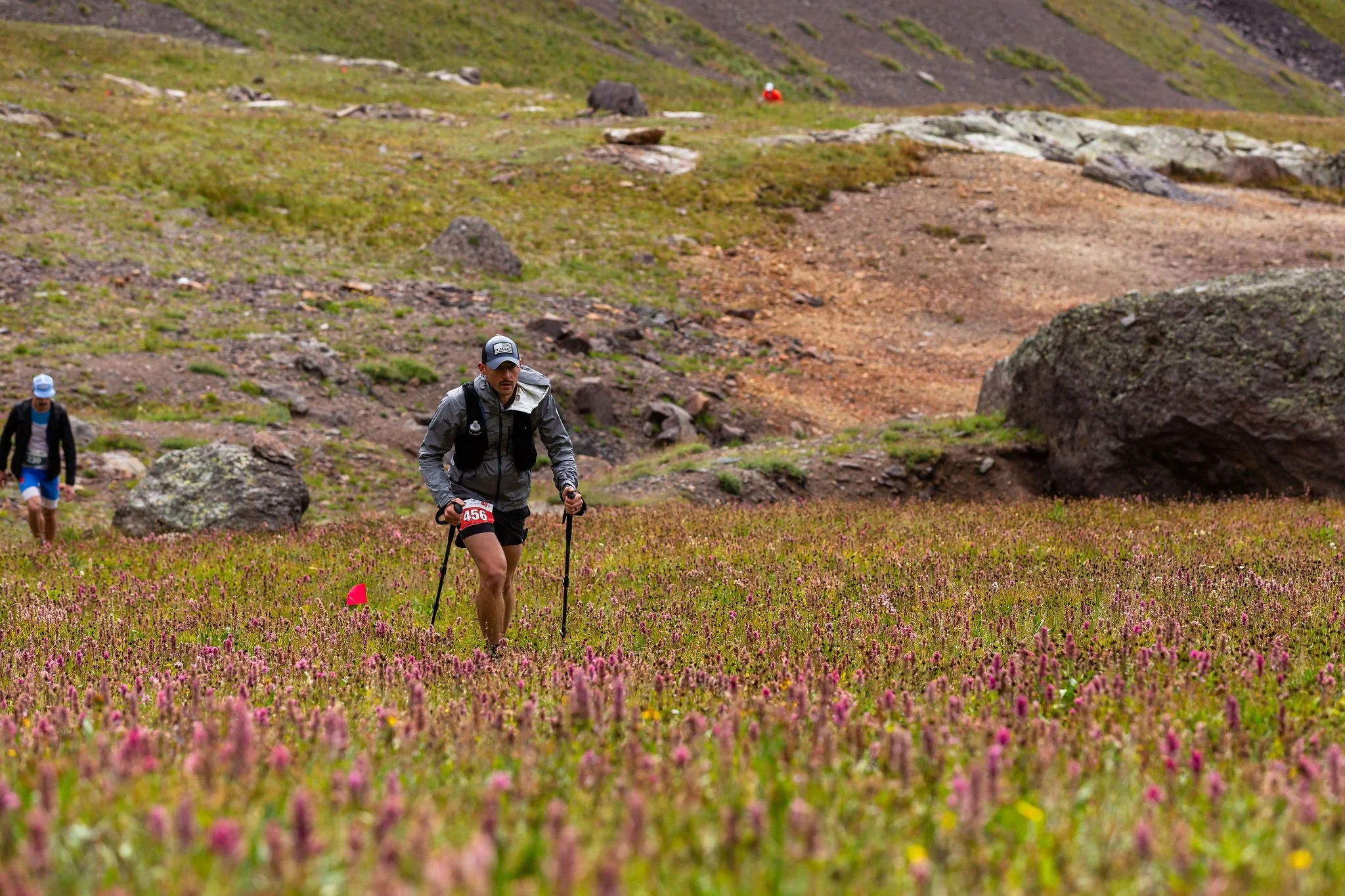
There will be nine fully stocked aid stations along the 65-mile course. All aid stations will be stocked with water, electrolyte drink, sweet and salty snacks, a small selection of warm food, first aid, and super nice volunteers! Aid stations on the back half of the 65-mile run will have a larger variety of hot food including soup/ramen/broth. Please note that these distances are approximate and might not perfectly match the elevation profile above. Cut-off times will be strictly enforced for the safety of the runners and support staff.
Drop Bags:
65-mile runners will be allowed to have three drop bags. Please mark all drop bags with your name and bib number and bring them to the starting line on Saturday morning. There will be a designated drop spot for each aid station.
Oak Street Aid Station (Mile 17)
Bridal Veil Aid Station (Mile 35)
Ophir Aid Station (Mile 56)
Pacers:
Pacing is allowed between Bridal Veil Aid Station (Mile 35) and the finish. Pacers must start and finish at aid stations and are required to carry the same mandatory gear as the runners. No “muling” allowed and one pacer at a time.
Crewing:
Crewing is allowed at:
Oak Street Aid Station (Mile 17)- Vehicle parking nearby
Bridal Veil Aid Station (Mile 35)- Hike required
Red Mountain Pass Aid Station (Mile 42)- Vehicle access
Burro Bridge Aid Station (Mile 50)- Vehicle access
Ophir Aid Station (Mile 56)- Hike required
Mandatory Gear:
Emergency Mylar Blanket
Headlamp w/ extra batteries
Phone with downloaded GXP file of the course (on your watch is not sufficient). We recommend a GPS program such as GAIA or onX with dowloaded maps of the area.
Hydration system
Calories
Waterproof Jacket
Other highly recommended items:
Reusable cup- TMR is a CUPLESS race. please bring your own reusable cup if you plan to drink at the aid stations and finish line.
Secondary light source
Warm clothing (jacket, gloves, hat). Temps can be near freezing at night above 13,000ft this time of year.
Sun block
Whistle
Course Markings:
The course will be well marked with flagging tape, ground flags, and directional signs at some intersections. The race organizers will do everything they can to have the course well marked for race participants the day of the event. Runners must follow trail markings and not cut switchbacks. Please be sure to understand the course! This is super important- Despite all our efforts to mark the course really well, some of our route marking have gone missing every year. We REQUIRE all 65-mile runners to download the course GPX file and have it available on their phone during the run.